
Smart Surveying, Smarter Infrastructure: TWWDA’s Leap into LiDAR Precision
By Eng. Erastus Waweru
In the rolling highlands of central Kenya, where rivers carve through valleys and communities depend on every drop, the Tana Water Works Development Agency (TWWDA) is quietly rewriting the rules of infrastructure planning. Tana Water Works Development Agency (TWWDA), operating within the Mount Kenya region, is embracing cutting-edge surveying technologies, a bold new approach to water and sanitation development that begins not with pipes or pumps, but with precision.
Surveying with Purpose
Every infrastructure project begins with a crucial phase of surveying, a strategic stage where community needs meet engineering foresight. For TWWDA, this isn’t just a technical requirement; it’s an essential pathway in project conception. Surveying lays the foundation for informed decision-making, community alignment, and sustainable development. The process encompasses:
- Site Assessment: Identifying optimal locations for water supply systems, treatment plants, and sewerage infrastructure by analysing geographical, environmental, and social factors.
- Data Collection: Gathering insights on water resources, population density, and sanitation conditions to inform infrastructure capacity.
- Stakeholder Engagement: Collaborating with communities, government bodies, local leaders, and partners to align project goals with local needs.
- Technical Evaluation: Conducting feasibility studies on soil conditions, water quality, and existing utilities to anticipate challenges.
- Environmental Impact Assessment (EIA): Ensuring compliance with environmental regulations and promoting sustainability.
- Cost Analysis: Estimating construction and maintenance costs while exploring funding opportunities.
- Design Planning: Crafting preliminary layouts, engineering specifications, and operational guidelines.
- Monitoring and Evaluation: Establishing systems to track progress and assess long-term effectiveness.
These steps ensure that water and sanitation projects are not only technically sound but also socially responsive and environmentally sustainable. At TWWDA, we do not just create infrastructure to solve the immediate challenges, we focus on fostering long-term growth and development.
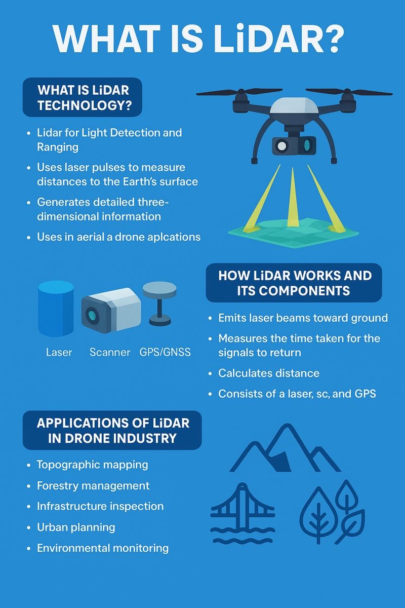
Enter LiDAR: From Ground to Sky-High Precision
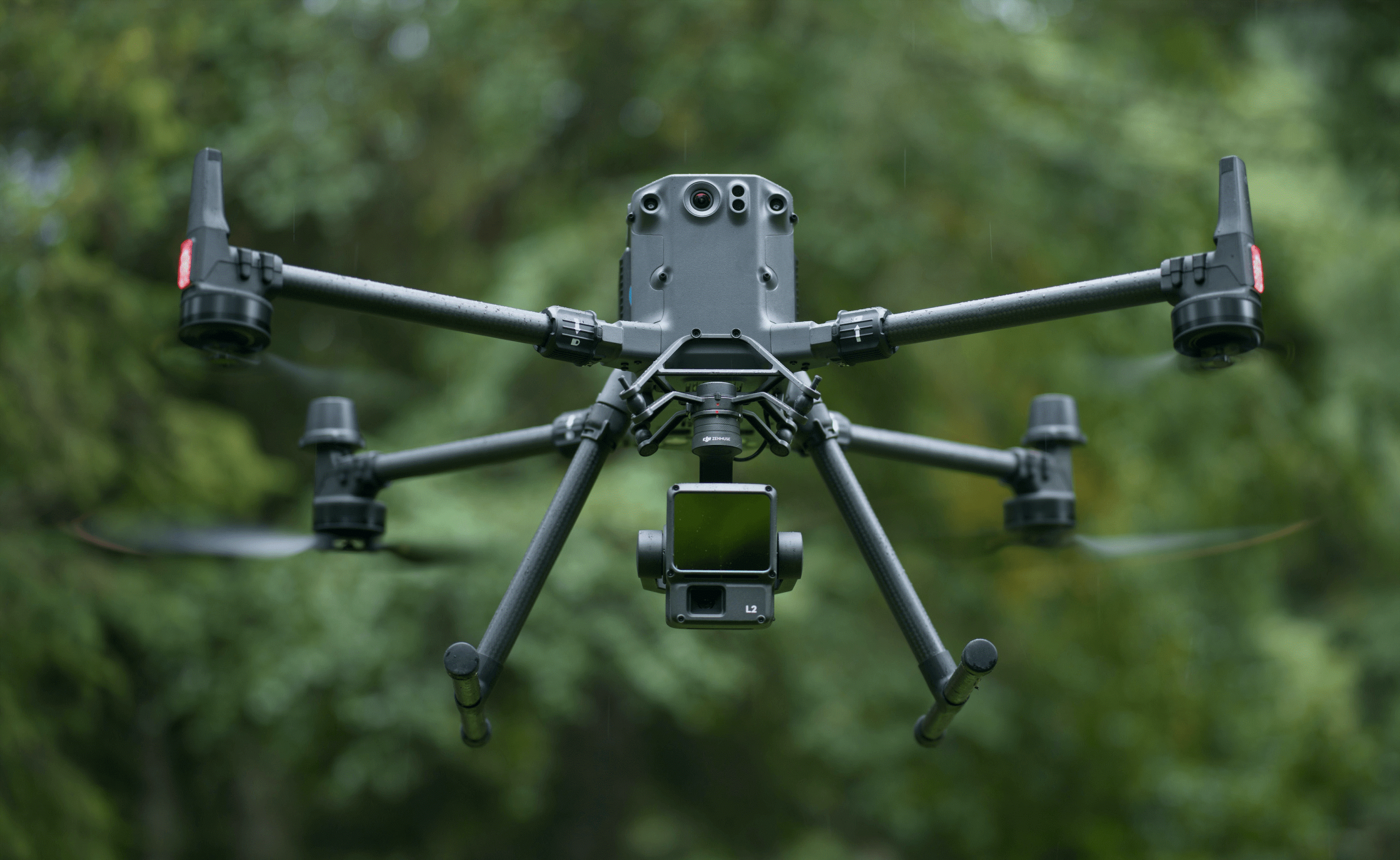
Traditionally, topographical surveying has been a slow and labour-intensive process. But TWWDA is rewriting the playbook. By adopting LiDAR (Light Detection and Ranging) technology, mounted on modern Unmanned Aerial Vehicles (UAVs) or drones, the Agency is unlocking new levels of speed, precision, and data richness.
| Feature | Traditional Surveying | LiDAR-Based Surveying (via Drone) |
| Data Collection | Manual, slow, point-by-point (Total Stations and GPS) | Automatic, high-speed laser-pulse scanning (millions of points per second) from an aerial platform. |
| Speed & Efficiency | Time-consuming, takes weeks for large or challenging terrain. | Extremely fast and efficient; large areas can be mapped in hours. |
| Data Density & Detail | Sparse data points, relying heavily on interpolation to map features. | Creates a dense 3D Point Cloud, offering a complete, high-resolution digital model of all features. |
| Vegetation Penetration | Difficult to measure the ground accurately under thick forest or tree canopy. | Laser pulses can penetrate gaps in vegetation, providing a highly accurate Digital Terrain Model (DTM). |
| Safety & Accessibility | Exposes field staff to hazards (steep slopes, wild animals, remote areas). | Data collection is remote, significantly enhancing staff safety and effortlessly reaching inaccessible locations. |
This shift is more than a technological upgrade; it’s a paradigm change. LiDAR enables high-resolution mapping of terrain, capturing intricate geospatial data that informs smarter designs and efficient resource allocation. With drones soaring over project sites, TWWDA can now visualize landscapes in unprecedented detail, accelerating planning timelines and reducing costly errors, while avoiding blind spots in project design.
For complex infrastructure projects, high-density LiDAR data is the foundation for success. By optimizing pipeline routes, preventing costly rework, and streamlining alignments, the Agency ensures efficient infrastructure planning, design, and development outcomes.
LiDAR has significantly improved the accuracy, efficiency, and safety of topographical surveys, thereby empowering planners and engineers to make better-informed decisions and accelerate infrastructure development. It has also enabled smarter use of public resources.
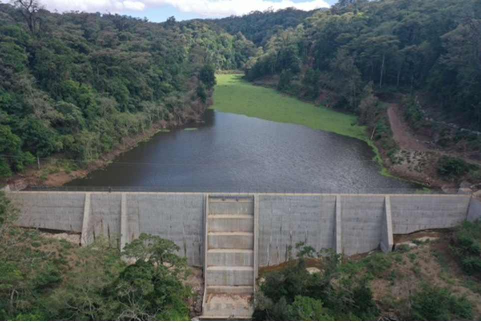
Case in Point: The Kururu Dam Breakthrough
Nestled within the Chehe Forest Station in Karatina, the proposed Kururu Dam site posed a formidable and prohibitive challenges. From dense vegetation, steep slopes, wet climatic conditions to the presence of wild animals, traditional surveying was nearly impossible to execute.
But with drone-mounted LiDAR, TWWDA turned a logistical nightmare into a model of modern engineering through:
- Rapid Data Capture: A high-density point cloud of the entire site was collected in record time—no weeks in the field, no boots, no pangas (machetes), no raincoats. In just a fraction of the time, the team had all the data which was reliable.
- Precision Design: The resulting Digital Terrain Model enabled accurate reservoir volume calculations and optimal dam placement, which led to a more robust and cost-effective design from the outset.
- Risk Reduction: Detailed topographical data revealed potential landslide zones and drainage paths, allowing engineers to proactively design for safety and resilience. Such level of detail could not be available using the traditional methods of survey.
This smart approach enabled TWWDA expedite the preparatory stage, significantly shaving weeks off the project timeline and delivered insights that were previously unattainable.
Engineering with Intelligence
As Kenya intensifies efforts to achieve universal access to water and sanitation, innovations like smart surveying are indispensable. For TWWDA, embracing LiDAR is more than a nod to innovation, it’s a strategic imperative. It reflects a deep commitment to precision engineering which is evidence based, fiscal responsibility, and community impact. With smart surveying at its core, TWWDA is positioning itself to meet that demand with agility, accuracy, and accountability.
Because in the end, building water-secure communities isn’t just about what we construct, it’s about how we begin the process. And for TWWDA, it all starts with seeing the land clearly, listening to the people closely, and designing with purpose.
By paving the way for precision, the Agency is not just building pipelines and treatment plants—it’s laying the groundwork for healthier communities, resilient ecosystems, and a future where every infrastructure decision is guided by data, dialogue, and vision.